Vintage Aerial Mystery Monday
Mystery Monday
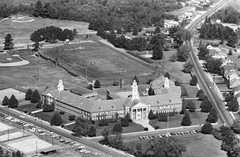
Shortly after I ordered my photograph of Rucker in May 2011, I found out about this contest/challenge Vintage Aerial posts on their blog on Monday. They show a photograph from their archive and challenge anyone to find out (or remember) the location of that photo. Sometimes they give hints, but mostly you are left to your own devices to try to figure out the location shown. Vintage Aerial estimates that more than 40% of their photographs show buildings/farms/etc. which are no longer around, adding to the challenge if you don't happen to be familiar with the area shown in the photo.
Occasionally they even show photographs for which they cannot determine a precise location — i.e. they know what county, and usually which general area in the county, but nothing more specific.
Solving Resources on Vintage Aerial
- Discover Your Photos
- All scanned film rolls for a county: vintageaerial.com/photos/state/county/rolls
- Thumbnail images of all scanned frames on a film roll: vintageaerial.com/photos/state/county/year/sequence/rollnumber
- Webpage for individual frame: roll page/framenumber
- Note: for multi-word states and counties/parishes, separate the words with a hyphen (-)
Other helpful information for solving
- States which do not require front license plates on personal automobiles: AL, AZ, AR, DE, FL, GA, IN, KS, KY, LA, MI, MS, NM, NC, OK, PA, SC, TN, WV. They are optional in MA.
- County and Physical maps for every state
Google Earth / Google Maps
Here are KMZ placemarks I've created for the Mystery Mondays I've solved or otherwise found interesting. Click on any photo to download the KMZ file showing the location of that photo. If you have Google Earth, you can open the KMZ file downloaded by double-clicking on it or using File/Open while Google Earth is running. KMZ files can also be loaded into NASA's World Wind or many GIS applications.
Alternatively, you may also copy the KMZ URL (by right-clicking on the image and selecting something like "Copy Link Address"; don't copy the image address): go to Google Maps, paste that URL into the search box, and click the blue button. For some reason, you may need to zoom out a little bit to get a decent view (I don't know why Google Maps doesn't respect the view altitude set in the KMZ file).
Click on a date (under the photos) to visit the Vintage Aerial blog page for that Mystery Monday.
The One That Got Away
This was the first Mystery Monday blog I read, and probably the one I've spent the most time on. No one (include Vintage Aerial) has been able to locate the buildings in this Mystery Monday photo from 1964 Beaver County, PA. I even went through several years of historical society newsletters from Beaver County (available in our Allen County Library's Genealogy Department) hoping to find a picture of one of these buildings.
There were three blog posts about it:
Mystery Solving Blog
When I first began solving a few Mystery Mondays I kept a blog of that experience, usually with a discussion of how I went about solving them. I kind of stopped doing that after the first three. They have been saved for posterity at Mystery Monday Blog (defunct).


